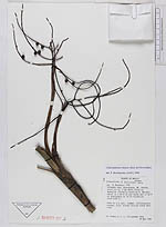
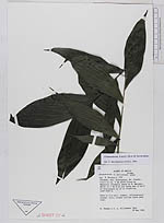
| Collector | Thomas, W. |
| Number | 3664 |
| Collected with | Villasenor, J. L. |
| Country | Mexico |
| Subpart | Chiapas |
| County | |
| Locality | Mun. Acacoyagua, Mt Ovando, trail to ca. 5 km above Finca La Magnolia (formerly owned by E. Matuda), which is 3 km N of Los Cacao and 13 km N of Acacoyagua on rd to Olondrina. |
| Coordinates | |
| Minimum elevation (m) | 1200 |
| Maximum elevation (m) | 1500 |
| Start date | 1985/05/29 |
| End date | 1985/05/29 |
| Family | Arecaceae |
| Identification | Chamaedorea linearis (Ruiz & Pav.)Mart. |
| Determined by | Borchsenius, F. |
| Identification qualifier | |
| Field notes | Palm to 2 m tall, common, inflorescence orange, fruit orange turning black when ripe. |
|