AAU Herbarium Database |
| New Search Modify Search |
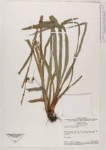
| Collector | Anderson, W.R. |
| Number | 10675 |
| Collected with | |
| Country | Brazil |
| Subpart | Para |
| County | |
| Locality | Estado do Pará. Alto Tapajos, Rio Cururú. Marshy campo and low wet forest near canal SE of Missão Cururú |
| Coordinates | 7° 35' S 57° 31' W |
| Minimum elevation (m) | 140 |
| Maximum elevation (m) | 140 |
| Start date | 1974/02/08 |
| End date | 1974/02/08 |
| Family | Cyperaceae |
| Identification | Calyptrocarya glomerulata (Brongn.)Urb. |
| Determined by | T.Koyama 1987 |
| Identification qualifier | |
| Field notes | Wet campo |
| |
 Other records of Calyptrocarya glomerulata Other records of Calyptrocarya glomerulataThe map displays only records from the Aarhus Herbarium Database. The records may not represent the full distribution of Calyptrocarya glomerulata |
| New Search Modify Search |