AAU Herbarium Database |
| New Search Modify Search |
| Collector | Palacios, W. |
| Number | 457 |
| Collected with | D.Neil, J.Zaruma |
| Country | Ecuador |
| Subpart | Napo |
| County | |
| Locality | 8 km río abajo de Puerto Misahualli, por el RIo Napo y 1.5 km al Sur. Bosque Muy Humedo Tropical. Suelo rojo arcilloso, lateritico, de baja fertilidad. Bosque primario. |
| Coordinates | 1° 4' S 77° 36' W |
| Minimum elevation (m) | 450 |
| Maximum elevation (m) | 450 |
| Start date | 1985/05/18 |
| End date | 1985/05/30 |
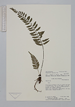
| Family | Aspleniaceae |
| Identification | Asplenium auritum Sw. |
| Determined by | R. C. Moran |
| Identification qualifier | |
| Field notes | |
| |
| Display all 140 georeferenced records of Asplenium Asplenium auritum |
| New Search Modify Search |