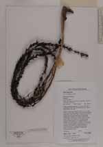
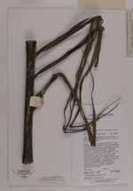
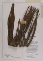
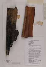
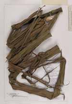
| Field notes | Steep, somewhat degraded, montane forest with exceptionally high epiphyte load due to the unusually high rainfall in the area. Solitary, moderately robust tree palm to 10m. Stem diameter 10cm, stem slightly ventricose directly below crownshaft. Internodes 15cm. Crown with 10 leaves, leaves ascending and recurving with ascending leaflets which droop at their apices. Crownshaft 216cm long x 10cm wide. Sheath 120cm long, with dense pale brown tomentum. Leaf 240cm long including 32cm petiole, young leaves emerging somewhat bronze-coloured. Leaflets 43 each side of rachis, arranged regularly. Inflorescence 70cm long including 12cm peduncle, horsetail-shaped, 11 primary branches, c.23 rachillae, prophyll and peduncular bract purple-green. Pistillate and staminate flowers white. |
 Other records of Gronophyllum