| Collector | Baker, W.J. |
| Number | 1132 |
| Collected with | Roy Banka, Kathleen King, Anthony Elemi |
| Country | Papua New Guinea |
| Subpart | Western |
| County | |
| Locality | North Fly District Road from Tabubil to Ok Tedi copper mine, 8.5km N of Tabubil, c.2km NW of Finalbin |
| Coordinates | 5° 12' 31.2'' S 141° 10' 42.4'' E |
| Minimum elevation (m) | 1000 |
| Maximum elevation (m) | 1000 |
| Start date | 2000/12/12 |
| End date | 2000/12/12 |
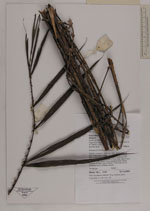
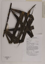
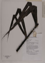
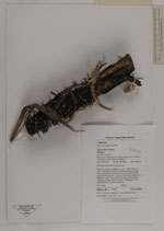
| Family | Arecaceae |
| Identification | Calamus |
| Determined by | |
| Identification qualifier | |
| Field notes | Montane hill forest on limestone. Robust, clustering rattan to c.15m. Stem diam. 34cm. Internode c.20cm. Sheath densely covered with purple-black indumentum and numerous stiff, yellow-green spines. Ocrea c.70cm long, papery and tattered. Leaf 120cm long, including 20cm petiole. Leaflets 30 each side of rachis, in fascicles of 1-4, divergent and in different planes |
|