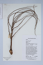
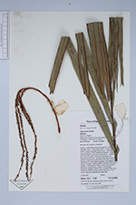
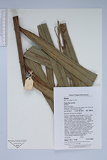
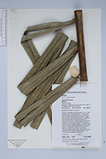
| Field notes | Solitary, moderately robust tree palm to c.5m. Stem diameter 10cm. Internodes 4-5cm. Crown with 8 leaves, leaves arranged distichously. Leaf 380cm long, including 170cm sheath and petiole. Sheath with abundant rusty brown indumentum. Leaflets 35 each side of rachis, somewhat ascending, but drooping at their tips, arranged regurlarly except for a section in the centre of the rachis of some (not all) leaves which lacks leaflets appears, the leaflets either side of the gap in slightly different planes to all other leaflets. Inflorescence 180cm long including 60cm peduncle, branched to 2 orders, c.25 primary branches, largest to 52cm long. Prophyll 52cm long distinctly pointed, woody and stiff when dry. Fruit unripe, epicarp resembling orange peel. |
 Other records of Orania