AAU Herbarium Database |
| New Search Modify Search |
| Collector | Camp, W.H. |
| Number | E-4194 |
| Collected with | |
| Country | Ecuador |
| Subpart | Azuay |
| County | |
| Locality | Vicinity of the lake in the vally of the río Surucuchu (a br. of the río Matadero), 18-20 km west of Cuenca |
| Coordinates | |
| Minimum elevation (m) | 2987.04 |
| Maximum elevation (m) | 3139.44 |
| Start date | 1945/07/16 |
| End date | 1945/07/16 |
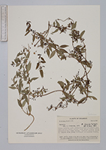
| Family | Rubiaceae |
| Identification | Manettia pisifera Wernham |
| Determined by | J.H. Kirkbride, Jr. |
| Identification qualifier | |
| Field notes | Vine, usually with much-contorted branches. Lvs deep green, nitid above; pale green below, veins prominent and dark green. Corolla usually deeply tinged with pink; internal pubescens white |
| |
| This record has no coordinates. Display map with the 26 georeferenced records of Manettia pisifera in the AAU Herbarium Database. |
| New Search Modify Search |