AAU Herbarium Database |
| New Search Modify Search |
| Collector | Burger, W.C. |
| Number | 8336 |
| Collected with | |
| Country | Costa Rica |
| Subpart | San Jose |
| County | |
| Locality | High montane oak forest with trees 8-20. tall on slopes and ridges, along trail from Canaan to Chirripo via Los Angeles, above (north of ) the Rio Talari. |
| Coordinates | 9° 30' N 83° 32' W |
| Minimum elevation (m) | 3100 |
| Maximum elevation (m) | 3200 |
| Start date | 1971/08/24 |
| End date | 1971/08/24 |
| Family | Boraginaceae |
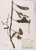
| Identification | Hackelia revoluta (Ruiz & Pav.)I.M. Johnst. |
| Determined by | H.H.Hilger & M.Weigend |
| Identification qualifier | |
| Field notes | In an open area of secondary growth on old landslide. Flowers pale blue with white center |
| |
 Other records of Hackelia revoluta Other records of Hackelia revolutaThe map displays only records from the Aarhus Herbarium Database. The records may not represent the full distribution of Hackelia revoluta |
| New Search Modify Search |