| Collector | Zak, V. |
| Number | 1744 |
| Collected with | |
| Country | Ecuador |
| Subpart | Bolivar |
| County | |
| Locality | Carretera Santiago-San Vicente-Alizo “San Augustin”. Rio Tataguazo. Restos de vegetacion de bosque nublado. Suelo humifero. |
| Coordinates | |
| Minimum elevation (m) | 2500 |
| Maximum elevation (m) | 2500 |
| Start date | 1987/02/24 |
| End date | 1987/02/24 |
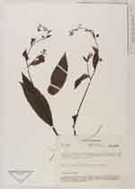
| Family | Boraginaceae |
| Identification | Hackelia revoluta (Ruiz & Pav.)I.M. Johnst. |
| Determined by | H.H.Hilger & M.Weigend |
| Identification qualifier | |
| Field notes | Hierba de 50 cm, caliz verde, corola lila |
|