AAU Herbarium Database |
| New Search Modify Search |
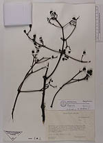
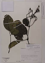
| Collector | Zak, V. |
| Number | 1321 |
| Collected with | |
| Country | Ecuador |
| Subpart | Pichincha |
| County | |
| Locality | Carretera Quito-San Juan-Chiriboga-Empalme, Km. 59 59, a 16 Km. al NO de la carretera. Colecciones en bosque nublado de vegetación primaria y pastizal, bioma mesotermico e hygrófilo |
| Coordinates | |
| Minimum elevation (m) | 1700 |
| Maximum elevation (m) | 2200 |
| Start date | 1986/09/25 |
| End date | 1986/09/25 |
| Family | Staphyleaceae |
| Identification | Turpinia megaphylla Tul. |
| Determined by | Hanna Nydegger |
| Identification qualifier | |
| Field notes | Arbol de 15m, Frutos verdes |
| |
| This record has no coordinates. Display map with the 10 georeferenced records of Turpinia megaphylla in the AAU Herbarium Database. |
| New Search Modify Search |