AAU Herbarium Database |
| New Search Modify Search |
| Collector | Zak, V. |
| Number | 1316 |
| Collected with | |
| Country | Ecuador |
| Subpart | Pichincha |
| County | |
| Locality | Reserva Floristica-Ecológica "RIO GUAJALITO", km. 59 de la carreterra antigua Quito-Sto. Domingo de los Colorasdos, a 3 1/2 km al NE de la carreterra, estrabaciones occidentales del Volcán Pichincha |
| Coordinates | 0° 13' 53'' S 78° 48' 10'' W |
| Minimum elevation (m) | 1800 |
| Maximum elevation (m) | 2200 |
| Start date | 1986/09/24 |
| End date | 1986/09/24 |
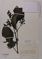
| Family | Staphyleaceae |
| Identification | Turpinia |
| Determined by | |
| Identification qualifier | |
| Field notes | Arbol de 10m. Flores color verde |
| |
 Other records of Turpinia Other records of TurpiniaThe map displays only records from the Aarhus Herbarium Database. The records may not represent the full distribution of Turpinia |
| New Search Modify Search |