AAU Herbarium Database |
| New Search Modify Search |
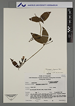
| Collector | Sunthorn, V.A. |
| Number | 76 |
| Collected with | P. Palee |
| Country | Thailand |
| Subpart | Chiang Mai |
| County | |
| Locality | Muang District. Doi Sutep-Pui National Park, Puping Village. |
| Coordinates | |
| Minimum elevation (m) | 1400 |
| Maximum elevation (m) | 1400 |
| Start date | 1992/09/17 |
| End date | 1992/09/17 |
| Family | Acanthaceae |
| Identification | Thunbergia laevis var. vestita (Nees) L.H.Cramer |
| Determined by | H. Balslev |
| Identification qualifier | |
| Field notes | Open and partly shaded, destroyed parts of the primary evergreen hardwood + pine forest; grassy places; granite bedrock Vine; stems, pestioles, peduncles light green; sepels pale light greenish; corolla white, one area at the base of one petal pale light yellow; blades dull dark green above, light green underneath. In liquid collection. Topotype |
| |
| This record has no coordinates. Display map with the 1 georeferenced records of Thunbergia laevis var. vestita in the AAU Herbarium Database. |
| New Search Modify Search |