AAU Herbarium Database |
| New Search Modify Search |
| Collector | Blicher-Mathiesen, U. |
| Number | 62617 |
| Collected with | Klitgaard, B. B. |
| Country | Ecuador |
| Subpart | MANABI |
| County | |
| Locality | Suma-Pedernales rd. km 22, Hacienda El Pedregal. Pasture. |
| Coordinates | 0° 10' S 79° 38' W |
| Minimum elevation (m) | 400 |
| Maximum elevation (m) | 400 |
| Start date | 1987/12/22 |
| End date | 1987/12/22 |
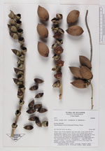
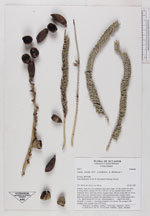
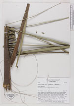
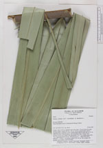
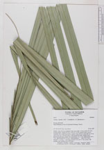
| Family | Arecaceae |
| Identification | Attalea colenda (O. F. Cook)H. Balslev & A. Henderson |
| Determined by | |
| Identification qualifier | |
| Field notes | Solitary. Stem 16,23 m, columnar, erect, gray, diam. 63 cm. Leaves 26, erect, arching; sheath + petiole 297 cm x 100 cm x 24 cm, rounded below, brown, channeled above, glabrouse, brown, margins sharp, fibrous; rachis 680 cm, 13 cm wide, 8 cm cross, channeled above, with a prominent ridge, rounded below, tapering towards apex; pinnae 146, basal pinnae 115 x 1 cm. middle pinnae 183 x 7 cm, apical pinnae 84 x 0,2 cm. Infructescences 3 ( half of the fruits ( afkasted) + 1 young + 1 decaying); prophyll 114 x 45 cm. The younger: 640 rachillae, each rachillae with 16-23 fruits. |
| |
 Other records of Attalea colenda Other records of Attalea colendaThe map displays only records from the Aarhus Herbarium Database. The records may not represent the full distribution of Attalea colenda |
| New Search Modify Search |