AAU Herbarium Database |
| New Search Modify Search |
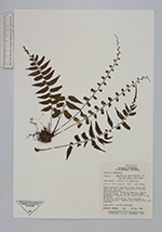
| Collector | Hawkins, T. |
| Number | 391 |
| Collected with | |
| Country | Honduras |
| Subpart | Olancho |
| County | |
| Locality | La Chorrera. Moist tropical lowland forest along and above Río Lara, composed of diverse hardwood species. Area around la Chorrera campsite, Agalta National Park. 17 km NNW of Catacamas, Department Olancho on the north side of the mountain. |
| Coordinates | 15° 0' N 85° 56' W |
| Minimum elevation (m) | 1100 |
| Maximum elevation (m) | 1100 |
| Start date | 1992/05/30 |
| End date | 1992/05/30 |
| Family | Aspleniaceae |
| Identification | Asplenium auriculatum Sw. |
| Determined by | R. C. Moran |
| Identification qualifier | |
| Field notes | 50 cm tall terrestial fern growing in rotting leaves. Spores very light brown and indented. |
| |
| Display all 65 georeferenced records of Asplenium Asplenium auriculatum |
| New Search Modify Search |