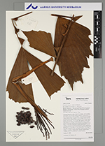
| Field notes | Colonial understory palm. Stem 2-4 m high, 1.5-2 cm thick; internodes 7-10 cm long, brown, smooth. Visible roots 10-20, 5-20 cm long, 0.3-0.4 cm thick. Crownshaft 20 cm long. Leaves 6-8 per stem; sheath 15-20 cm long, closed; petiole 20-25 cm long, section round; rachis 40-50 cm long; lamina pinnate, 60 cm long, 50 cm wide, flat; pinnae 4-6 per side; basal pinna 15 cm long, middle pinna 25 cm long, apical pinna 18 cm long. Inflorescence interfoliar; prophyll 12 cm long, 1.5 cm wide, light green; peduncular bracts 2, 18-20 cm long, inserted 7 and 12 cm from base, green, herbaceous; peduncle 25-35 cm long, 0.5 cm wide; rachis 5 cm long, 0.4 cm wide; rachillae 10, 8-12 cm long. Flowers sessile. Fruits orange, 1 cm long, 0.8 cm wide. Silicagel sample taken. Transect: HB 765, subunit no. 1, inside transect |
 Other records of Iriartella setigera