AAU Herbarium Database |
| New Search Modify Search |
| Collector | Emilio, T. |
| Number | 836 |
| Collected with | H. Balslev & D. Pedersen |
| Country | Brazil |
| Subpart | Amazonas |
| County | |
| Locality | Río Juruá. 290 km SW of Carauari. 109 km E of Eirunepé. 2 km SE of Alta Mira. primary forest on terrace |
| Coordinates | 6° 35' 26.8'' S 68° 52' 48.8'' W |
| Minimum elevation (m) | 123 |
| Maximum elevation (m) | 123 |
| Start date | 2012/04/19 |
| End date | 2012/04/19 |
| Family | Arecaceae |
| Identification | Geonoma macrostachys var. macrostachys Mart. |
| Determined by | H.Balslev & T. Emilio |
| Identification qualifier | |
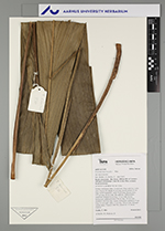
| Field notes | Solitary understory palm. Acaulescent. Base with few visible roots. Leaves 10; sheath 16 cm long, closed; petiole 15 cm long, section margined; rachis 76 cm long; lamina entire; 112 cm long, 22 cm wide, flat, glabrous. Inflorescence interfoliar; prophyll 8 cm long, 1.3 cm wide, brown, herbaceous; peduncular bract 18 cm long, 0.9 cm wide, inserted 5 cm from base, brown, herbaceous; peduncle 55 cm long, 0.5 cm wide; spike 12 cm long, 0.8 cm wide. Silicagel sample taken. Transect: HB 764, subunit no. 15, inside transect |
| |
| Display all 220 georeferenced records of Geonoma Geonoma macrostachys var. macrostachys |
| New Search Modify Search |