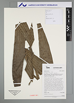
| Field notes | Cespitose understory palm. Stem 2.5 m high, 1.5 cm thick; internodes 8-10 cm long, > stem diameter, brown-green, smooth. Visible roots 30, 10-20 cm long, 0.3 cm thick. Crownshaft 25 cm long. Leaves 7 per stem; sheath 19 cm long, closed; petiole 17 cm long, section margined; rachis 42 cm long; lamina pinnate, 75 cm long, 75 cm wide, flat, glabrous; pinnae 6 per side, irregularly inserted; basal pinna 52 cm long, middle pinna 52 cm long, apical pinna 42 cm long. Inflorescence infrafoliar; prophyll 13 cm long, 1.5 cm wide, green, herbaceous; peduncular bract 25 cm long, 1 cm wide, inserted 2 cm from base, brown, herbaceous; peduncle 3.5 cm long, 0.8 cm wide; rachis 3.5 cm long, 0.5 cm wide; rachillae 12, 12-13 cm long. Flowers cream to light yellow, pedicilate. Silicagel sample taken. Transect: HB 762, to transect |