AAU Herbarium Database |
| New Search Modify Search |
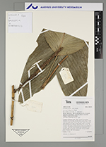
| Collector | Emilio, T. |
| Number | 826 |
| Collected with | H. Balslev & D. Pedersen |
| Country | Brazil |
| Subpart | Amazonas |
| County | |
| Locality | Río Juruá. 269 km SW of Carauari. 126 km E of Eirunepé. 1.5 km N of Barro Vermelho. Primary forest on terra firme |
| Coordinates | 6° 26' 50.2'' S 68° 44' 54.7'' W |
| Minimum elevation (m) | 165 |
| Maximum elevation (m) | 165 |
| Start date | 2012/04/17 |
| End date | 2012/04/17 |
| Family | Arecaceae |
| Identification | Geonoma stricta var. trailii (Burret)A.J.Hend. |
| Determined by | H.Balslev & T. Emilio |
| Identification qualifier | |
| Field notes | Cespitose understory palm. Stem 1 m tall, 0.8 cm thick; internodes 8-10 cm long, smooth, brown-green. Base of stem with few visible roots. Leaves 3 per stem; sheath 10 cm long, open; petiole 12 cm long, section round; rachis 23 cm long, brown furfuraceous beneath; lamina entire, 35 cm long, 18 cm thick, flat, glabrous. Infructescence infrafoliar; prophyll 9 cm long, 1 cm wide, brown, herbaceous; peduncular bract missing; spike 14 cm long, 0.8 cm wide. Silicagel sample taken. Transect: HB 762, to transect |
| |
| Display all 69 georeferenced records of Geonoma Geonoma stricta var. trailii |
| New Search Modify Search |