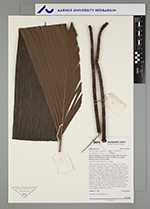
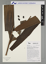
| Field notes | Solitary understory palm. Stem 2.5 m high, 4-5 cm thick; internodes 1 cm long, brown, smooth. Visible roots 50, 5-15 cm long, 0.4 cm thick. Leaves 17, old wilted leaves hanging from crown; sheath 10 cm long, open; petiole 80 cm long, section margined; rachis 69 cm long; lamina pinnate, 105 cm long, 90 cm wide, flat; pinnae 5-6 per side, insertion regular; basal pinna 53 cm long, middle pinna 63 cm long, apical pinna 65 cm long. Infructescence interfoliar; prophyll 30 cm long, 6.5 cm wide, brown, woody; peduncular bract 28 cm long, 3.5 cm wide, inserted 18 cm from base, brown, woody; peduncle 52 cm long, 2.3 cm wide, brown furfuraceous; rachis 16 cm long, 2 cm wide; rachillae 12, 19-42 cm long. Fruits black, 1.8 cm long, 1.1 cm wide. Silicagel sample taken. Transect: HB 762, to transect |
 Other records of Pholidostachys synanthera