AAU Herbarium Database |
| New Search Modify Search |
| Collector | Emilio, T. |
| Number | 806 |
| Collected with | H. Balslev & D. Pedersen |
| Country | Brazil |
| Subpart | Amazonas |
| County | |
| Locality | Río Juruá. 250 km SW of Carauari. 161 km E of Eirunepé. 1.7 km SW of Canta Galo. Primary forest on terrace |
| Coordinates | 6° 33' 2.4'' S 68° 25' 9'' W |
| Minimum elevation (m) | 129 |
| Maximum elevation (m) | 129 |
| Start date | 2012/04/13 |
| End date | 2012/04/13 |
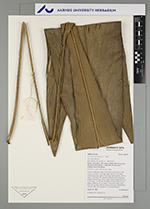
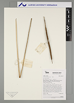
| Family | Arecaceae |
| Identification | Geonoma macrostachys var. macrostachys Mart. |
| Determined by | H.Balslev & T. Emilio |
| Identification qualifier | |
| Field notes | Solitary understory palm. Acaulescent. Roots few visible. Leaves 9; sheath 15 cm long, open; petiole 15 cm long, section margined; rachis 77 cm long; lamina entire, 102 cm long, 22 cm wide, flat, glabrous. Inflorescence interfoliar; prophyll 10 cm long, 1.4 cm wide, brown; peduncular bract 25 cm long, 1.1 cm wide, inserted 2 cm from base, brown, papery; peduncle 55 cm long, 0.3 cm wide; spike 14 cm long, 0.8 cm wide. Flowers sunken. Silicagel sample taken. Transect: HB 758, subunit no. 47, inside transect |
| |
| Display all 220 georeferenced records of Geonoma Geonoma macrostachys var. macrostachys |
| New Search Modify Search |