AAU Herbarium Database |
| New Search Modify Search |
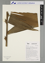
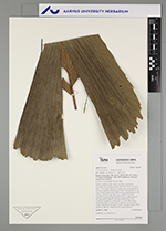
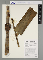
| Collector | Emilio, T. |
| Number | 802 |
| Collected with | H. Balslev & D. Pedersen |
| Country | Brazil |
| Subpart | Amazonas |
| County | |
| Locality | Río Juruá. 226 km SW of Carauari. 177 km E of Eirunepé. 5 km NW of Itamarati. Primary forest on terra firme |
| Coordinates | 6° 23' 28.7'' S 68° 16' 56.2'' W |
| Minimum elevation (m) | 168 |
| Maximum elevation (m) | 168 |
| Start date | 2012/04/11 |
| End date | 2012/04/11 |
| Family | Arecaceae |
| Identification | Wettinia augusta Poepp. & Endl. |
| Determined by | H.Balslev & T. Emilio |
| Identification qualifier | |
| Field notes | Solitary midstory palm. Stem 10 m high, 6 cm thick; internodes 10 cm long, smooth. Stilt roots 20-30, 30-50 cm long, 3-4 cm wide, with 0.3 cm long spines. Crownshaft 64 cm long. Leaves 8, sheath 64 cm long, closed; petiole 34 cm long, section round; rachis 280 cm long; lamina pinnate, 260 cm long, 120 cm wide, flat, hairy; pinnae 19 per side, insertion regular; basal pinna 44 cm long, middle pinna 70 cm long, apical pinna 25 cm long. Inflorescence buds infrafoliar; prophyll 2-3 cm long, 1-1.5 cm wide, woody; peduncular bract 2-3 cm long, inserted 1-2 cm from base, cream with brown tomentum, woody. Silicagel sample taken. Transect: HB 756, subunit no. 95, outside transect |
| |
 Other records of Wettinia augusta Other records of Wettinia augustaThe map displays only records from the Aarhus Herbarium Database. The records may not represent the full distribution of Wettinia augusta |
| New Search Modify Search |