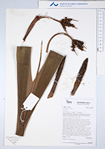
| Field notes | Cespitose understory palm. Stem 0.6 m high, 1 cm thick; internodes 5 cm long, smooth, black. Leaves 8 per stem; sheath 15 cm long, closed, with to 4 cm long black spines; petiole 30 cm long, section round, with to 6 cm long black spines; rachis 28 cm long, with to 4 cm long black spines; lamina entire, 65 cm long, 30 cm wide, flat, hairy. Inflorescence interfoliar. Prophyll 8.5 cm long, 1.3 cm wide, woody; peduncular bract 19 cm long, inserted 3.5 cm from base, brown, woody, with 1 cm long black/brown spines; peduncle 15 cm long, 0.7 cm wide; rachis 1 cm long, 0.5 cm wide; rachillae 3, 5-6 cm long. Flowers cream, sessile. Fruits green, 0.8 cm long, 0.6 cm wide, spinulose. Silicagel sample taken. Transect: HB 755, subunit no. 3, inside transect |