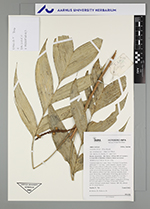
| Field notes | Cespitose understory palm. Stem 1.5 m high, 0.6 cm thick; internodes 5-7 cm long, > stem diameter, smooth, brown. Base of stem without visible roots. Leaves 10 per stem; sheath 7 cm long, open; petiole 17 cm long, section round; rachis 20 cm long; lamina pinnate, 26 cm long, 20 cm wide, flat, glabrous; pinnae 3 per side, insertion irregular; basal pinna 18 cm long, middle pinna 18 cm long, apical pinna 15 cm long. Inflorescence interfoliar; prophyll 6.5 cm long, 1 cm wide, brown, papery; peduncular bract 3.5 cm long, inserted 2 cm from base, brown, papery; peduncle 6 cm long, 0.5 cm wide; spike 12 cm long, 0.4 cm wide. Flowers sunken. Silicagel sample taken. Transect: HB 748, subunit no. 19, inside transect |