AAU Herbarium Database |
| New Search Modify Search |
| Collector | Emilio, T. |
| Number | 761 |
| Collected with | H. Balslev & D. Pedersen |
| Country | Brazil |
| Subpart | Amazonas |
| County | |
| Locality | Río Juruá. 152.5 km SW of Carauari. 1 km W of Belomonte. Primary forest on terrace. |
| Coordinates | 5° 51' 40.2'' S 67° 51' 40.6'' W |
| Minimum elevation (m) | 101 |
| Maximum elevation (m) | 101 |
| Start date | 2012/04/02 |
| End date | 2012/04/02 |
| Family | Arecaceae |
| Identification | Geonoma atrovirens Borchs. & Balslev |
| Determined by | H.Balslev & T. Emilio |
| Identification qualifier | |
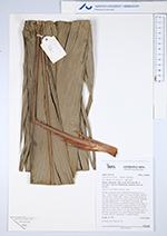
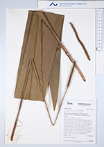
| Field notes | Solitary understory palm. Acaulescent; internodes 21 cm long, < stem diameter, rough, covered by leafbases. Base of stem with few visible roots. Leaves 11 per stem; sheath 20 cm long, open; petiole 25 cm long, section round; rachis 99 cm long; lamina entire, 127 cm long, 14 cm wide, flat, glabrous. Infructescence interfoliar; prophyll 20 cm long, 1.2 cm wide, brown, herbaceous; peduncular bract 26 cm long, inserted 3 cm from base, red, herbaceous; peduncle 75 cm long, 0.5 cm wide; rachis 17 cm long, 0.8 cm wide; spike 14 cm long. Fruits green, very small. Silica gel sample taken Transect: HB 747, subunit no. 1, outside transect |
| |
 Other records of Geonoma atrovirens Other records of Geonoma atrovirensThe map displays only records from the Aarhus Herbarium Database. The records may not represent the full distribution of Geonoma atrovirens |
| New Search Modify Search |