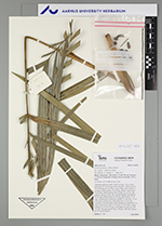
| Field notes | Cespitose understory palm. Stem 4 m high, 1.8 cm thick; internodes 10-15 cm long, brown, smooth. Visible roots 30, 10-20 cm long, 0.3 cm thick. Leaves 8 per stem; sheath 10 cm long, closed; petiole 4-5 cm long, section round; rachis 55 cm long; lamina pinnate, 80 cm long, 70 cm wide, flat, glabrous; pinnae 16 per side, insertion regular; basal pinna 44 cm long, middle pinna 45 cm long, apical pinna 27 cm long. Infructescence infrafoliar; prophyll 13 cm long, 2.3 cm wide, green, herbaceous; peduncular bract 12 cm long, inserted 0.5 cm from base, green, herbaceous; peduncle 9 cm long, 0.8 cm wide; rachis 11 cm long, 0.5 cm wide, orange; rachillae 12, 13-16 cm long. Fruits green, 0.9 cm long, 0.8 cm wide. Silicagel sample taken. Transect: HB 746, subunit no. 50, inside transect |

 Other records of Geonoma maxima subsp. compta