AAU Herbarium Database |
| New Search Modify Search |
| Collector | Emilio, T. |
| Number | 753 |
| Collected with | H. Balslev & D. Pedersen |
| Country | Brazil |
| Subpart | Amazonas |
| County | |
| Locality | Río Juruá. 88 km SW of Carauari. 0.5 km SE of Barreira. Secondary forest on terrace |
| Coordinates | 5° 28' 46.7'' S 67° 24' 47.5'' W |
| Minimum elevation (m) | 100 |
| Maximum elevation (m) | 100 |
| Start date | 2012/03/31 |
| End date | 2012/03/31 |
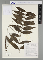
| Family | Arecaceae |
| Identification | Desmoncus mitis subsp. leptospadix (Mart.) A.J. Hend. |
| Determined by | H.Balslev & T. Emilio |
| Identification qualifier | |
| Field notes | Cespitose understory palm. Liana. Stem 2 m long, 0.5 cm thick; internodes 10 cm long. Leaf sheath 10+ cm long; petiole 8 cm long, section round; lamina pinnate, flat; pinnae 10 per side. Infructescence interfoliar. Fruits red. Silicagel sample taken. Transect: HB 745 from transect |
| |
| Display all 31 georeferenced records of Desmoncus Desmoncus mitis subsp. leptospadix |
| New Search Modify Search |