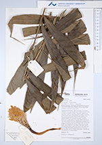
| Field notes | Solitary understory palm. Stem 50 cm high, 1.5 cm thick; internodes 3 cm long, smooth, black. Visible roots 30, 15-20 cm long, 0.3 cm thick. Leaves 11 per stem; sheath 32 cm long, open, with 2 cm long black spines; petiole 72 cm long, section round, with 4 cm long black spines; rachis 55 cm long; lamina pinnate, 80 cm long, 45 cm wide, bushy, glabrous; pinnae 10-12 per side, irregularly inserted in groups of 2-3; basal pinna 25 cm long, middle pinna 30 cm long, apical pinna 25 cm long. Inflorescence: prophyll 12 cm long, 2.8 cm wide, herbaceous; peduncular bract 25 cm long, inserted 2.5 cm from base, brown, woody, with 1 cm long brown spines; peduncle 11 cm long, 1.2 cm wide, with 0.5 cm long brown spines; rachis 4 cm long, 0.5 cm wide, with 0.1 cm long brown spines; rachillae ca. 25, 3-5 cm long. Flowers cream, sessile. Silicagel sample taken. Transect: HB 744, subunit no. 1, outside transect |
 Other records of Bactris maraja var. juruensis