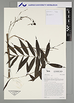
| Field notes | Cespitose understory palm. Liana. Stem aerial; internodes 10-15 cm long, > stem diameter, green, smooth, covered by leaf sheaths. Leaves 20 per stem; sheath 10-15 cm long, closed; petiole 5 cm long, section round; rachis 40 cm long, with 0.2 cm long green/black spines; cirrhus 30+ cm long, with modified spine like pinnae; lamina pinnate, 40 cm long, 15 cm wide, flat, glabrous; pinnae 7-11 per side, insertion regular; basal pinna 8 cm long, middle pinna 11 cm long, apical pinna 7 cm long. Infructescence interfoliar; prophyll 9 cm long, 0.4 cm wide, papery; peduncular bract 25 cm long, inserted 1 cm from base, light brown, papery; peduncle 27 cm long, 0.1 cm wide; rachis 3 cm long, 0.1 cm wide; rachillae 3, 3-5 cm long. Fruits green, 0.9 cm long, 0.6 cm wide. Silicagel sample taken. Transect: HB 740 , from transect |
 Other records of Desmoncus mitis var. mitis