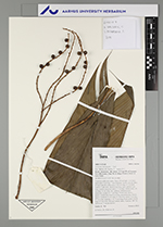
| Field notes | Cespitose understory palm. Stem 120 cm high, 1 cm thick; internodes 1 cm long, > stem diameter, brown, smooth. Base of stem with 20 visible roots, 5-10 cm long, 0.2 cm thick. Leaves 11 per stem; sheath 6 cm long, open; petiole 6 cm long, section margined; rachis 33 cm long; lamina entire, 43 cm long, 11 cm wide, flat, glabrous. Infructescence infrafoliar; prophyll 5-7 cm long, 0.9 cm wide, brown, papery; peduncular bract 6 cm long, inserted at base, brown, papery; peduncle 13 cm long, 0.3 cm wide; rachis 3 cm long, 0.3 cm wide; rachillae 3, 12-15 cm long. Fruits green, 0.4 cm long, 0.5 cm wide. Silicagel sample taken. Transect: HB 740, subunit no. 7, inside transect |