AAU Herbarium Database |
| New Search Modify Search |
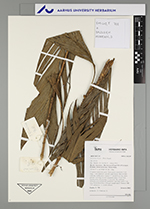
| Collector | Emilio, T. |
| Number | 708 |
| Collected with | H. Balslev & D. Pedersen |
| Country | Brazil |
| Subpart | Amazonas |
| County | |
| Locality | Río Juruá, 6.5 km NW of Carauari. Primary forest on terrace. Terra firme |
| Coordinates | 4° 54' 16.1'' S 66° 56' 52.7'' W |
| Minimum elevation (m) | 110 |
| Maximum elevation (m) | 110 |
| Start date | 2012/03/24 |
| End date | 2012/03/24 |
| Family | Arecaceae |
| Identification | Geonoma stricta var. stricta (Poit.)Kunth |
| Determined by | H.Balslev & T. Emilio |
| Identification qualifier | |
| Field notes | Cespitose understory palm. Stem aerial; internodes 5 cm long, > stem diameter, smooth, light brown. Base of stem with few visible roots. Leaves 12; sheath 8 cm long, open; petiole 7 cm long, section margined; rachis 34 cm long; lamina entire, 40 cm long, 11 cm wide, flat, glabrous. Infructescence infrafoliar; peduncle 4 cm long; rachis 7 cm long. Fruits black/blue. Silicagel sample taken. Transect: HB 739, subunit no. 11, inside transect |
| |
| Display all 90 georeferenced records of Geonoma Geonoma stricta var. stricta |
| New Search Modify Search |