AAU Herbarium Database |
| New Search Modify Search |
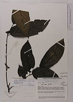
| Collector | SEF, |
| Number | 10360 |
| Collected with | |
| Country | Ecuador |
| Subpart | Napo |
| County | |
| Locality | Añangu, Rain forest on level, periodically inundated ground, dominated by palms, near the outlet of Rio Anangu into Río Napo, in the Parque Nacional Yasuní |
| Coordinates | 0° 31' S 76° 24' W |
| Minimum elevation (m) | 250 |
| Maximum elevation (m) | 250 |
| Start date | 1982/06/30 |
| End date | 1982/07/09 |
| Family | Staphyleaceae |
| Identification | Huertea glandulosa Ruiz & Pav. |
| Determined by | Hanna Nydegger |
| Identification qualifier | |
| Field notes | DBH 14.4 cm. Shallow buttresses. Bark fissured, brown, 4 mm thick. Slash yellow-brown |
| |
 Other records of Huertea glandulosa Other records of Huertea glandulosaThe map displays only records from the Aarhus Herbarium Database. The records may not represent the full distribution of Huertea glandulosa |
| New Search Modify Search |