| Collector | SEF, |
| Number | 10344 |
| Collected with | |
| Country | Ecuador |
| Subpart | Napo |
| County | |
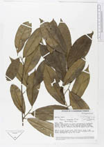
| Locality | Añangu. Rain forest on level, periodically inundated ground, dominated by palms, near the outlet of Rio Añangu into Rio NApo, in the Parque Nacional Yasuni |
| Coordinates | 0° 31' S 76° 24' W |
| Minimum elevation (m) | 250 |
| Maximum elevation (m) | 250 |
| Start date | 1982/06/30 |
| End date | 1982/07/09 |
| Family | Dichapetalaceae |
| Identification | Tapura amazonica Poepp. & Endl. |
| Determined by | |
| Identification qualifier | |
| Field notes | DBH ca 18 cm. Fluted base. Bark warty, grey, 6 mm thick. Slash brown, but more or less streaked with red veins. Strangling fig on its trunk |
|
 Other records of Tapura amazonica