| Collector | |
| Number | SEF10075 |
| Collected with | |
| Country | Ecuador |
| Subpart | Napo |
| County | |
| Locality | Añangu. Rain forest on level, periodically inundated ground, dominated by palms, near the outlet of Río Añangu into Río Napo, n the parque Nacional Yasuní |
| Coordinates | 0° 31' S 76° 24' W |
| Minimum elevation (m) | 250 |
| Maximum elevation (m) | 250 |
| Start date | 1982/06/30 |
| End date | 1982/09/09 |
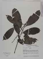
| Family | Annonaceae |
| Identification | Guatteria modesta Diels |
| Determined by | P.J.M.Maas & L.Y.Th.Westra |
| Identification qualifier | |
| Field notes | DBH 24.2 cm. Buttresses 50 cm high, 70 cm wide. Bark smooth, green to grey, 1 cm thick. Slash light yellow. Without latex |
|
 Other records of Guatteria modesta