| Collector | Malcomber, S.T. |
| Number | 1307 |
| Collected with | G.E.Schatz, et al. |
| Country | Madagascar |
| Subpart | Fianarantsoa |
| County | |
| Locality | Parc National Ranomafana, 2-4 km N of Route National 46-Route National 25 junction, Western side of Namorona river. |
| Coordinates | 21° 16' S 47° 21' E |
| Minimum elevation (m) | 1080 |
| Maximum elevation (m) | 1080 |
| Start date | 1992/03/06 |
| End date | 1992/03/06 |
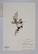
| Family | Aspleniaceae |
| Identification | Asplenium theciferum (H.B.K.)Mett. |
| Determined by | R.C.Moran |
| Identification qualifier | |
| Field notes | Epiphyte on Ficus; pinnae fleshy, medium green, sporangia medium brown. 1080 m. |
|
 Other records of Asplenium theciferum