AAU Herbarium Database |
| New Search Modify Search |
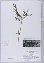
| Collector | Ziegler, S.R. |
| Number | 2303 |
| Collected with | M.F.Leykom |
| Country | USA |
| Subpart | Minnesota |
| County | |
| Locality | Houston Co.; Island 7; Missisipi River-mile #687.9; T103N R4W Sec 36. Age of dredge material-5yr; Normal Pool elevation-631 ft. Island on west side of main channel; specimen growing on sandy, beach area being invaded by young Salix, eastern side of Island |
| Coordinates | |
| Minimum elevation (m) | 193.2432 |
| Maximum elevation (m) | 193.2432 |
| Start date | 1975/08/20 |
| End date | 1975/08/20 |
| Family | Convolvulaceae |
| Identification | Cuscuta |
| Determined by | |
| Identification qualifier | |
| Field notes | |
| |
| This record has no coordinates. Display map with the 6 georeferenced records of Cuscuta in the AAU Herbarium Database. |
| New Search Modify Search |