AAU Herbarium Database |
| New Search Modify Search |
| Collector | Laegaard, S. |
| Number | 52013 |
| Collected with | |
| Country | Ecuador |
| Subpart | NAPO |
| County | |
| Locality | Along road Tena - Baeza between Sarayuacu and Cosanga. Roadslopes and cloud-forest. |
| Coordinates | 0° 40' S 77° 52' W |
| Minimum elevation (m) | 1750 |
| Maximum elevation (m) | 1750 |
| Start date | 1984/04/22 |
| End date | 1984/04/22 |
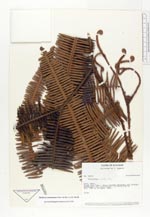
| Family | Gleicheniaceae |
| Identification | Sticherus tomentosus (Sw.)A. R. Sm. |
| Determined by | Andersen, E.O. (AAU), 1996. |
| Identification qualifier | |
| Field notes | Slope |
| |
 Other records of Sticherus tomentosus Other records of Sticherus tomentosusThe map displays only records from the Aarhus Herbarium Database. The records may not represent the full distribution of Sticherus tomentosus |
| New Search Modify Search |