AAU Herbarium Database |
| New Search Modify Search |
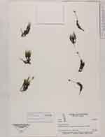
| Collector | Laegaard, S. |
| Number | 102137 |
| Collected with | |
| Country | Ecuador |
| Subpart | COTOPAXI |
| County | |
| Locality | Angamarca-road, km 5 from junction to road Latacunga - La Maná. Páramo with some rocky outcrops and springs. |
| Coordinates | 1° 0' S 78° 55' W |
| Minimum elevation (m) | 4100 |
| Maximum elevation (m) | 4200 |
| Start date | 1992/04/05 |
| End date | 1992/04/05 |
| Family | Cyperaceae |
| Identification | Phylloscirpus deserticola (Phil.)Dhooge & Goetgh. |
| Determined by | Sandra Dhooge |
| Identification qualifier | |
| Field notes | |
| |
 Other records of Phylloscirpus deserticola Other records of Phylloscirpus deserticolaThe map displays only records from the Aarhus Herbarium Database. The records may not represent the full distribution of Phylloscirpus deserticola |
| New Search Modify Search |