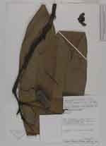
| Collector | Knapp, S. |
| Number | 6926 |
| Collected with | J.Mallet |
| Country | Peru |
| Subpart | San Martin |
| County | |
| Locality | Lamas. Naranjal, trail to Jorge Chavez, km 85 of Tarapoto-Yurimaguas road. Tropical wet forest on white sand |
| Coordinates | 6° 15' S 76° 17' W |
| Minimum elevation (m) | 200 |
| Maximum elevation (m) | 200 |
| Start date | 1986/04/02 |
| End date | 1986/04/02 |
| Family | Annonaceae |
| Identification | Guatteria megalophylla Diels |
| Determined by | Maas & Setten(U)1988.Maas & Westra 2011 |
| Identification qualifier | |
| Field notes | Treelet 4-5 m. Flowers pale creamy yellow |
|
 Other records of Guatteria megalophylla