AAU Herbarium Database |
| New Search Modify Search |
| Collector | Liesner, R. |
| Number | 14016 |
| Collected with | Morillo,G. |
| Country | Venezuela |
| Subpart | Bolivar |
| County | |
| Locality | ESTADO BOLIVAR. Caño Pablo, tributary of Río Caura, ca 6 to 9 km east of Río Caura ca 10 km east south east of Las Pavas (Salto Para). 240 m alt. Primary forest and river edge |
| Coordinates | 6° 14' N 64° 23' W |
| Minimum elevation (m) | 240 |
| Maximum elevation (m) | 240 |
| Start date | 1982/05/10 |
| End date | 1982/05/10 |
| Family | Dennstaedtiaceae |
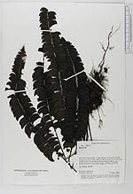
| Identification | Lindsaea lancea (L.)Bodd. |
| Determined by | |
| Identification qualifier | |
| Field notes | On steep slope |
| |
| Display all 39 georeferenced records of Lindsaea Lindsaea lancea |
| New Search Modify Search |