AAU Herbarium Database |
| New Search Modify Search |
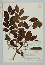
| Collector | Geesink, R. |
| Number | 5985 |
| Collected with | D. Phanichapol & T. Santisuk |
| Country | Thailand |
| Subpart | Maehongson |
| County | |
| Locality | 15 km N.W. of Maehongson |
| Coordinates | 18° 45' N 98° 0' E |
| Minimum elevation (m) | 400 |
| Maximum elevation (m) | 500 |
| Start date | 1973/06/20 |
| End date | 0/00/00 |
| Family | Fabaceae |
| Identification | Dalbergia cana Kurz |
| Determined by | C. Niyomdham |
| Identification qualifier | |
| Field notes | Mixed deciduous forest along trail, on limestone. Tree, rather shrubby, Fr. Brown, pendulous. |
| |
 Other records of Dalbergia cana Other records of Dalbergia canaThe map displays only records from the Aarhus Herbarium Database. The records may not represent the full distribution of Dalbergia cana |
| New Search Modify Search |