AAU Herbarium Database |
| New Search Modify Search |
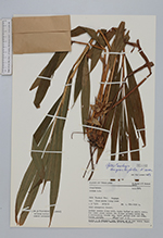
| Collector | Geesink, R. |
| Number | 5157 |
| Collected with | T.Santisuk |
| Country | Thailand |
| Subpart | Pangnga |
| County | |
| Locality | Khao Pawta Luang Keow. Hill evergreen forest. |
| Coordinates | 9° 15' N 98° 20' E |
| Minimum elevation (m) | 800 |
| Maximum elevation (m) | 1000 |
| Start date | 1973/05/02 |
| End date | 1973/05/02 |
| Family | Zingiberaceae |
| Identification | Geostachys angustifolia K.Larsen |
| Determined by | K.Larsen |
| Identification qualifier | |
| Field notes | Rather common along path, laxly tufted on stilt roots. The bract wich covers the flower already dried up, 3 surrounding bracts red. Petal yellow with red dots. Stamen yellow. |
| |
 Other records of Geostachys angustifolia Other records of Geostachys angustifoliaThe map displays only records from the Aarhus Herbarium Database. The records may not represent the full distribution of Geostachys angustifolia |
| New Search Modify Search |