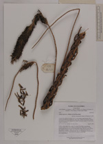
| Collector | Bernal, R. |
| Number | 4549 |
| Collected with | H. Balslev, G. Galeano, L. Mesa, D. Pedersen, J.C. Garcés, F.J. Horacio, N. Morueta, L. Skov Jensen, A. Gaitan and R. Gaitan |
| Country | Colombia |
| Subpart | Vichada |
| County | |
| Locality | Río Guaviare N bank, 4 km N of Murciélago, approximately 500 m inland to the NW across Theobroma cacao stand , 185 km W of Inírida. Tropical rain forest on flood plain dominated by Attalea butyracea; canopy 20 m tall, many tangles in understory. |
| Coordinates | 3° 36' 12.1'' N 69° 34' 59.8'' W |
| Minimum elevation (m) | 132 |
| Maximum elevation (m) | 0 |
| Start date | 2009/09/26 |
| End date | 0/00/00 |
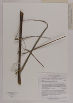
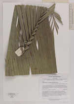
| Family | Arecaceae |
| Identification | Attalea butyracea (Murtis ex L.f) Wess.Boer |
| Determined by | R. Bernal & H. Balslev |
| Identification qualifier | |
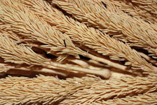
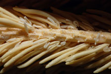
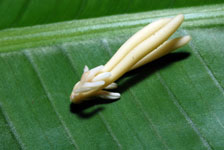
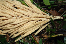
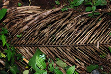
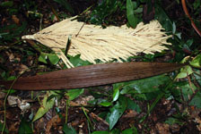
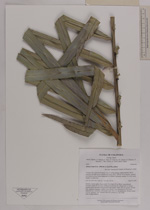
| Field notes | Solitary, canopy palm. Stem aerial, 12 m high, 26 cm thick, longitudinally fissured. Leaves 23 per stem, arching towards the tips with pinnae in vertical position (leaf specimen from juvenile individual); rachis 720 cm; pinnae 163 per side, regularly arranged; middle pinna 120x6.5 cm, apical pinna 32x0.4 cm. Inflorescence interfoliar; peduncular bract 188 x 22 cm; peduncle 138 cm; rachis 112 cm; rachillae 238. Transect HB1028, subunit no. 52; UTM 19N-435222-398304. |
|