| Collector | Bernal, R. |
| Number | 4548 |
| Collected with | H. Balslev, G. Galeano, L. Mesa, D. Pedersen, J.C. Garcés, F.J. Horacio, N. Morueta, L. Skov Jensen, A. Gaitan and R. Gaitan |
| Country | Colombia |
| Subpart | Guainía |
| County | |
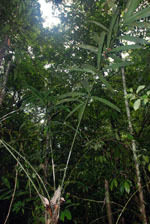
| Locality | Río Guaviare S bank, 2 km NE of Murciélago, approximately 600 m inland to the SE across Theobroma cacao stand and a small field, 185 km W of Inírida. Tropical rain forest on flood plain; canopy 20-30 m tall, many tangles in understory. |
| Coordinates | 3° 35' 3.4'' N 69° 34' 29.1'' W |
| Minimum elevation (m) | 128 |
| Maximum elevation (m) | 0 |
| Start date | 2009/09/26 |
| End date | 0/00/00 |
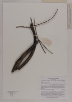
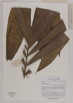
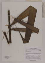
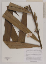
| Family | Arecaceae |
| Identification | Bactris brongniartii Mart. |
| Determined by | R. Bernal & H. Balslev |
| Identification qualifier | |
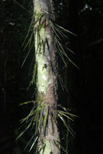
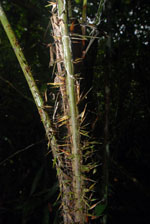
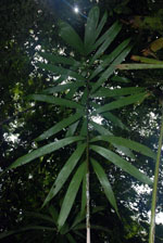
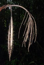
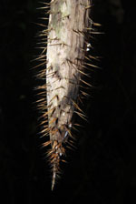
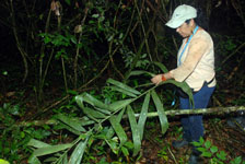
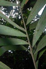
| Field notes | Colonial, midstory palm. Stems 11, aerial, 7 m high, 4.5 cm thick; internodes 11 cm long, >stem diameter, brown, with black, flat spines. Leaves 6-7 per stem; sheaths 32 cm long, open, with yellow spines; petiole with yellow spines; rachis 162 cm long, with yellow spines; pinnae 22-23 per side, in groups of 1-5, pendulous at tips, basal pinna 53 x 4 cm, middle pinna 58 x 6 cm, apical pinna 39 x 10 cm. Transect HB1027, subunit no. 082; UTM 19N-436168-396195. |
|