| Collector | Bernal, R. |
| Number | 4543 |
| Collected with | H. Balslev, G. Galeano, L. Mesa, D. Pedersen, J.C. Garcés, F.J. Horacio, N. Morueta, L. Skov Jensen, A. Gaitan and R. Gaitan |
| Country | Colombia |
| Subpart | Guainía |
| County | |
| Locality | Río Guaviare S bank, Barranco Picure, 7 km SW of Murciélago, approximately 3 km inland to the S across abandoned cattle pasture, 193 km WNW of Inírida. Tropical rain forest on low rolling terra firme hills; canopy 20-30 m tall, many thin stems. |
| Coordinates | 3° 32' 29.3'' N 69° 38' 36.8'' W |
| Minimum elevation (m) | 142 |
| Maximum elevation (m) | 0 |
| Start date | 2009/09/25 |
| End date | 0/00/00 |
| Family | Arecaceae |
| Identification | Geonoma macrostachys var. macrostachys Mart. |
| Determined by | R. Bernal & H. Balslev |
| Identification qualifier | |
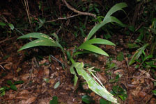
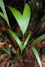
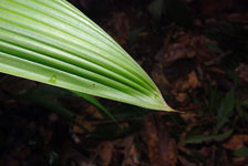
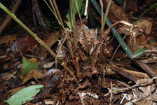
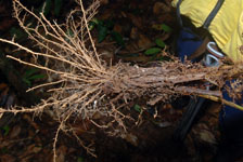
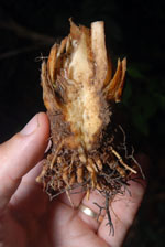
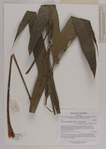
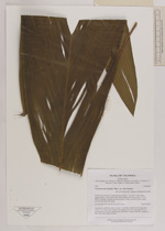
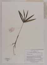
| Field notes | Acaulescent, understory palm. Leaves 11 per stem; sheaths 64 cm long, open; rachis 57 cm long; lamina pinnate, flat; pinnae 2 per side, basal pinna 49 cm, apical pinna 42 cm long. Inflorescence interfoliar. Transect HB1026, subunit no. 013; UTM 19N-428522-391469. |


|