| Collector | Bernal, R. |
| Number | 4542 |
| Collected with | H. Balslev, G. Galeano, L. Mesa, D. Pedersen, J.C. Garcés, F.J. Horacio, N. Morueta, L. Skov Jensen, A. Gaitan and R. Gaitan |
| Country | Colombia |
| Subpart | Guainía |
| County | |
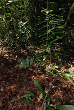
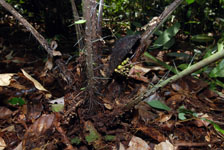
| Locality | Río Guaviare S bank, Barranco Picure, 5.6 km SW of Murciélago, approximately 2 km inland to the S across abandoned cattle pasture, 192 km WNW of Inírida. Tropical rain forest on low rolling terra firme hills; canopy 20-30 m tall, many thin stems. |
| Coordinates | 3° 32' 50.9'' N 69° 38' 7.6'' W |
| Minimum elevation (m) | 163 |
| Maximum elevation (m) | 0 |
| Start date | 2009/09/25 |
| End date | 0/00/00 |
| Family | Arecaceae |
| Identification | Bactris acanthocarpa var. acanthocarpa Mart. |
| Determined by | R. Bernal & H. Balslev |
| Identification qualifier | |
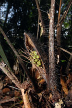
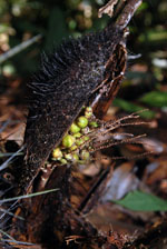
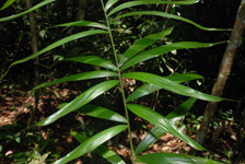
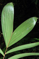
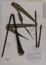
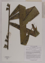
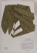
| Field notes | Acaulescent, understory palm. Leaves 9 per stem; sheaths 27.5 cm long, open, with black, 4 cm long spines; petiole 96 cm long; rachis 101 cm long, with black, to 4 cm long spines; lamina pinnate, bushy; pinnae 15 per side, arranged in groups of 1-4, basal pinna 35 cm, middle pinna 31 cm, apical pinna 35 cm long. Prophyll woody, 8.5 cm long; peduncular bract 24 cm long, brown, woody; peduncle 9.5 cm long, 0.9 cm thick, with black, 0.1 cm long spines; rachillae 17, 7-9 cm long. Fruits (immature) green. Transect HB1025, subunit no. 094; UTM 19N-429423-392131. |
|
 Other records of Bactris acanthocarpa var. acanthocarpa