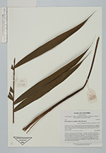
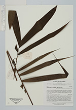
| Collector | Bernal, R. |
| Number | 4538 |
| Collected with | H. Balslev, L. Mesa, D. Pedersen, J.C. Garcés, F.J. Horacio, N. Morueta, L. Skov Jensen, A. Gaitan and R. Gaitan |
| Country | Colombia |
| Subpart | Guainía |
| County | |
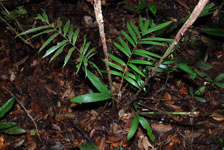
| Locality | Río Guaviare S bank, behind Murciélago, approximately 1 km inland to the SW from rivershore at the high point called Vista Hermosa, 188 km WNW of Inírida. Tropical rain forest on low rolling terra firme hills; canopy 20-30 m tall, many thin stems. |
| Coordinates | 3° 33' 31.8'' N 69° 36' .7'' W |
| Minimum elevation (m) | 161 |
| Maximum elevation (m) | 0 |
| Start date | 2009/09/24 |
| End date | 0/00/00 |
| Family | Arecaceae |
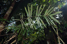
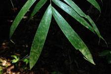
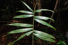
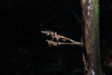
| Identification | Bactris hirta var. pectinata (Mart.)Govaerts |
| Determined by | R. Bernal & H. Balslev (COL&AAU), 2009 |
| Identification qualifier | |
| Field notes | Cespitose, understory palm. Stem aerial, 1.2 m high, 1 cm thick; internodes 6.5 cm long, >stem diameter, brown, smooth, with old leaf bases persisting. Leaves 3 per stem; sheaths 23 cm long, open, with black, 1 cm long spines; petiole 52.5 cm long, round in cross section; rachis 63 cm long; lamina pinnate, flat; pinnae 12 per side, inserted in groups of 1-5, basal pinna 24 cm, middle pinna 32 cm, apical pinna 26 cm long. Inflorescence infrafoliar. Transect HB1023, subunit no. 037; UTM 19N-433339-393385. |

|
 Other records of Bactris hirta var. pectinata