| Collector | Bernal, R. |
| Number | 4535 |
| Collected with | H. Balslev, L. Mesa, D. Pedersen, J.C. Garcés, F.J. Horacio, N. Morueta, L. Skov Jensen, A. Gaitan and R. Gaitan |
| Country | Colombia |
| Subpart | Guainía |
| County | |
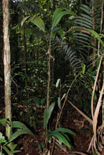
| Locality | Río Guaviare S bank, 4 km SSE of Murciélago, inland to the S across active and abandoned fields and into virgin forest; 183 km WSW of Inírida. Tropical rain forest on low rolling terra firme hills; canopy 20-30 m tall, many thin stems. |
| Coordinates | 3° 32' 18.9'' N 69° 34' 35.6'' W |
| Minimum elevation (m) | 179 |
| Maximum elevation (m) | 0 |
| Start date | 2009/09/23 |
| End date | 0/00/00 |
| Family | Arecaceae |
| Identification | Bactris hirta var. hirta Mart. |
| Determined by | R. Bernal & H. Balslev |
| Identification qualifier | |
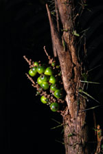
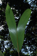
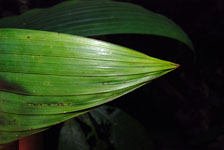
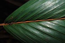
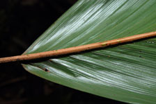
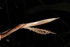
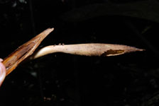
| Field notes | Understory palm. Stem 1.7 m high, 1 cm thick; internodes 7 cm long, >stem diameter, smooth and covered with old leaf bases towards the top. Leaves 4 per stem; sheaths open, with black, 2 cm long spines; petiole 36 cm long, margined in cross section; rachis 30 cm long; lamina entire, 62 cm long, 23 cm wide, flat. Infructescence infrafoliar. Transect HB1022, subunit no. 003, 019; UTM 19N-435964-391144. |
|