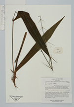
| Collector | Bernal, R. |
| Number | 4534 |
| Collected with | H. Balslev, L. Mesa, D. Pedersen, J.C. Garcés, F.J. Horacio, N. Morueta, L. Skov Jensen, A. Gaitan and R. Gaitan |
| Country | Colombia |
| Subpart | Guainía |
| County | |
| Locality | Río Guaviare S bank, 2.6 km SSE of Murciélago, inland to the S across active and abandoned fields and into virgin forest; 183 km WSW of Inírida. Tropical rain forest on low rolling terra firme hills; canopy 20-30 m tall, many thin stems. |
| Coordinates | 3° 32' 48.7'' N 69° 34' 42.9'' W |
| Minimum elevation (m) | 168 |
| Maximum elevation (m) | 0 |
| Start date | 2009/09/23 |
| End date | 0/00/00 |
| Family | Arecaceae |
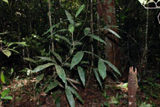
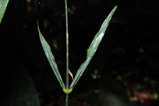
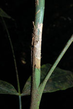
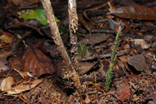
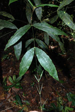
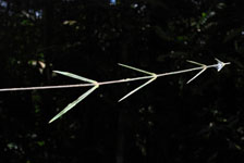
| Identification | Desmoncus giganteus A.J.Hend. |
| Determined by | R. Bernal & H. Balslev |
| Identification qualifier | |
| Field notes | Cespitose, understory, liana palm. Stem aerial, 2 m long, 1.1 cm thick including leafsheaths, 0.8 cm thick without leaf sheaths; internodes 12 cm long, >stem diameter, smooth, covered by leaf sheaths. Leaves 11 per stem; sheaths 28 cm long, closed, with brown, 3 cm long spines; petiole 24 cm long, round in cross section; rachis 22 cm long with 50 cm long cirrus; pinnae 2 plus 7 acanthophyls per side; basal pinna 39 cm, middle pinna 31 cm. Transect HB1021, subunit no. 095; UTM 19N-435739-392062. |
|