| Collector | Bernal, R. |
| Number | 4532 |
| Collected with | H. Balslev, L. Mesa, D. Pedersen, J.C. Garcés, F.J. Horacio, N. Morueta, L. Skov Jensen, A. Gaitan and R. Gaitan |
| Country | Colombia |
| Subpart | Guainía |
| County | |
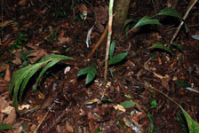
| Locality | Río Guaviare S bank, 2.6 km SSE of Murciélago, inland to the S across active and abandoned fields and into virgin forest; 183 km WSW of Inírida. Tropical rain forest on low rolling terra firme hills; canopy 20-30 m tall, many thin stems. |
| Coordinates | 3° 32' 52.7'' N 69° 34' 40.2'' W |
| Minimum elevation (m) | 169 |
| Maximum elevation (m) | 0 |
| Start date | 2009/09/23 |
| End date | 0/00/00 |
| Family | Arecaceae |
| Identification | Geonoma macrostachys var. macrostachys Mart. |
| Determined by | R. Bernal & H. Balslev |
| Identification qualifier | |
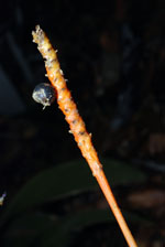
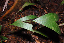
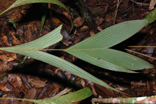
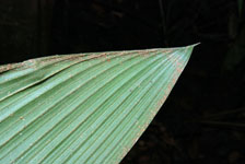
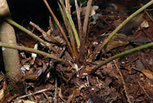
| Field notes | Solitary, acaulescent, understory palm. Stem 10 cm long, 3 cm thick. Leaves 7 per stem; sheaths 15 cm long, open; petiole 34 cm long; rachis 50 cm long; lamina pinnate, flat; pinnae 2 per side. Inflorescence interfoliar; peduncular bract 62 cm long. Transect HB1021, subunit no. 066; UTM 19N-435822-392183. |
|