AAU Herbarium Database |
| New Search Modify Search |
| Collector | Bernal, R. |
| Number | 4521 |
| Collected with | H. Balslev, L. Mesa, D. Pedersen, J.C. Garcés, F.J. Horacio, N. Morueta, L. Skov Jensen, A. Gaitan and R. Gaitan |
| Country | Colombia |
| Subpart | Guainía |
| County | |
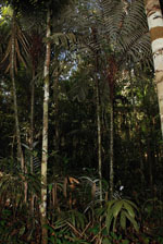
| Locality | Río Guaviare S bank, 2.5 km SE of Murciélago, inland to the S across active and abandoned fields; 184 km WSW of Inírida. Tropical rain forest on low rolling terra firme hills; canopy 20-30 m tall, many thin stems. |
| Coordinates | 3° 33' 33.3'' N 69° 34' 5.6'' W |
| Minimum elevation (m) | 161 |
| Maximum elevation (m) | 0 |
| Start date | 2009/09/22 |
| End date | 0/00/00 |
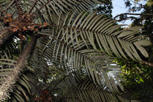
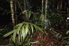
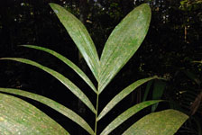
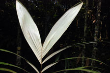
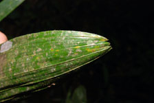
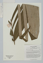
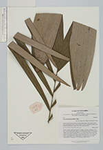
| Family | Arecaceae |
| Identification | Astrocaryum gynacanthum Mart. |
| Determined by | R. Bernal & H. Balslev |
| Identification qualifier | |
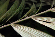
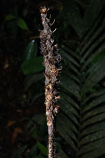
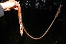
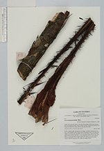
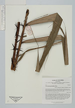
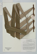
| Field notes | Solitary, midstory palm. Stem aerial, 4.2 m high, 5 cm thick; internodes 4.5 cm long, < stem diameter, black, with up to 8 cm long spines Leaves 10-12 per stem; sheaths 56 cm long, open, with black, 0.5-3 cm long spines; petiole 25 cm long, round in cross section, with black, 1-6 cm long spines; rachis 154 cm long, with black, 0.5-3 cm long spines; lamina pinnate, flat; pinnae 26 per side, regularly inserted, basal pinna 53 cm, middle pinna 67 cm, apical pinna 44 cm long. Transect HB1019, subunit no. 001; UTM 19N-436890-393430. |
| |
 Other records of Astrocaryum gynacanthum Other records of Astrocaryum gynacanthumThe map displays only records from the Aarhus Herbarium Database. The records may not represent the full distribution of Astrocaryum gynacanthum |
| New Search Modify Search |